Veliko Tarnovo municipality has updated its latest Town and Country Development Plan (TCDP)
According to the Bulgarian Law on spatial planning and overall development in the municipality the general structure of the regional plan and overwhelming use of its constituent structural parts being; location and boundaries of urban areas, farmland, forests, protected areas, contaminated areas and those with special and mixed use.
The TCDP gives general regimes for each of these areas with targets, measures and requirements for conservation use, building and development, identify networks and technical infrastructure facilities and areas with perhaps predictable natural disasters and necessary preventive measures and ways of planning and protection.
TCDP development for the municipality of Veliko Tarnovo has been done since 2006 adopted by the Town Council in April 2007. A preliminary draft TCDP was ready in 2008 and adopted by Town Council in 2009. In 2010 after a commission, an opinion needed to be sought on the environmental assessment . There have been meetings and coordination with environmental organisations, the guild of architects, the road agency, the Regional Directorate of Forestry, Water, Energy, National Institute of immovable cultural heritage, businesses, mayors and deputy mayors.
This plan is not “cast in stone” and is subject to change providing the resolution is by the Town Council. The TCDP of Veliko Turnovo bg Municipality aims to outline possibilities for territorial, economic, infrastructure and social development by 2025, with a continuity and balance up to this period and allowing continuity of development of Veliko Tarnovo real estate, thereafter. It covers an area of 885,406 sq km’s. Of these, 90.4 % are forests and agricultural use. The plan provides for these territories to reduce in area by 2.1 per cent in the agricultural use and forests by 0.1%. Urban area – residential and corporate construction, is 50,144 sq.km’s or 5.7 percent of the total area of the municipality.
By 2025 it is planned to increase by 18,256 sq.km’s. Waste sites total 265 sq. km’s, which is 0.03 percent of the municipality and targets to reduce landfill to 200 sq.km’s in total. 958 sq.km’s is expected to remain unchanged areas for mining, quarrying etc. For transportation links 10,227 sq.km’s, an increase of 1.2 percent.
New road links and economic centers
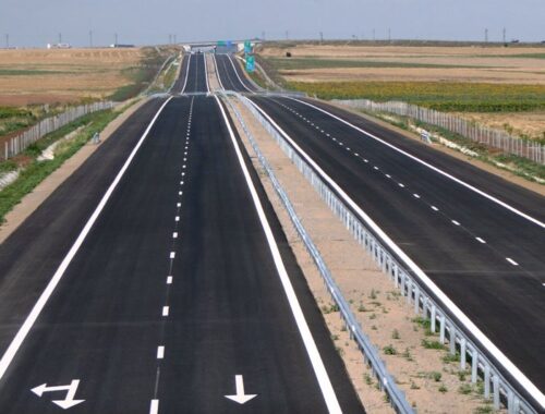
It is envisaged a new bypass route to the west of Veliko Turnovo to alleviate traffic on the Ruse – Stara Zagora. Commencing north of Samovodene and cross it south of Debelets and merging onto the existing road to Hainboaz Pass. This is the only viable and possible remaining route for the town bypass with, optimal closeness to the town centre. It has been suggested that the construction of part of the route through the protected area “Natura 2000” – “Turnovo Hills” is an acceptable compromise. Whenever there will be a need to build a ring then a thorough research plan involving risk mitigation techniques will be employed prior to a committed design. There are also plans to improve the class of road from Balvan to Emen and the Pavlikeni road from Momin sbor towards Hotnitsa and from Rusalya to Dichin and onto Pavlikeni. From Veliko Tarnovo to Shemshevo and then onto Kereka and from Velchevo to Kapinovo monastery and Plakovo to the lake “Yovkovtsi”.
TCDP plans to make new primary and country roads including a planned bypass of Balvan north of the village in relation to the road Sofia – Varna and a new road for the route from Momin sbor to Hotnitsa, and an eastern by-pass of Samovodene, new road from Vetrintsi to Pushevo an eastern bypass of Shemshevo and a northern bypass of Arbanasi.
The TCDP plan allows for Debelets, Kilifarevo, Resen, Samovodene, Balvan, Ledenik, Pchelishte ,Plakovo and Voneshta Voda to become the new secondary centres of the region.
Industrial facilities will be built near Balvan southwest from the road to Emen and an expansion of Western Industrial Zone of VT Bulgaria. Enterprise zones will have to be developed in Debelets by extending the industrial area on the bank of the river Dryanovska and in Kilifarevo east of the residential part of the village.
Mixed production, storage and logistics areas shall be provided north of Samovodene, north of Ledenik east of Debelets near the railway station, near Resen, Velchevo and north of the disused railway Tserova Koriya – Elena line. Agricultural centres are being planned to develop in Resen, Balvan, Tserova Koriya because of their proximity to infrastructure and communications.
Opportunities for development
In the TCDP it states that in future detailed plans for residential streets should have two rows of trees, arranged alternately, and at least 3 meters wide Footpaths and the cars will be parked on concrete grass pavers.

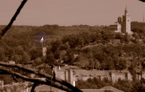
the Bulgarian national flag flies proudly over Tsaravets Hill, which is the centrepiece of Veliko Tarnovo, Bulgaria
Regarding housing development limited development into woodland will be in “Varusha” and in the Garga hill area northwest of Arbanasi. Maximum 3 storey properties in Veliko Tarnovo with a maximum built foot-print area of 250 sq.m and 500 sq.m of living area will be built in these areas and the building density will be a reduced 30 to 20%. Importantly, the allowable ratio of built-up area to the total area of the Bulgaria plot size cannot exceed 30%, with it being 60% prior to the changes. Each property’s garden / plot will have to be at least 80 percent landscaped.
Arbanasi and the architectural reserve, cannot expand its borders. According to the TCDP construction can be executed in the fields and forests only if a proven need for territorial expansion can be given in these settlements, including cemeteries, roads, warehouses.
An application to change agricultural fields cannot exceed 3 sqkm’s, no matter how large the plot. It is imperative that plots are facing the road, which classification must be at least 4th grade. These fields can change their function to build only roadside restaurant, facilities for processing and storage of agricultural products, and the owner of a house more than three floors.
New forest parks are planned for Kapinovo – Mindya – Plakovo – Velchevo” as well as north and east of Veliko Tarnovo and south between Arbanasi and Sheremetya, towards the end Kilifarevo-Yalovo and west of Gabrovo. In these areas there will be no change of land use from forest to built-out other than just tourist infrastructure, WC’s, recreational areas, picnic spots etc.
Holiday villages are expected to be allowed north of Emen on the ridge and west and east of Vetrintsi. A planned development of a long-distance service station, serving HGV traffic before diverted around Veliko Tarnovo near Nicopolis ad Istrum (North), Kilifarevo monastery to Hainboaz (South). Closed rural schools can be used for hospices and care homes for the elderly. There are prospects for hotels with a total capacity of at least 1,500 beds in addition to existing.
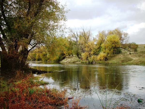
The TCDP states that old quarries are to be reclamation projects particularly near Samovodene and to Voneshta Voda and all former abandoned quarries and old riverbeds diggings too. They will provide landscaped parkland or agricultural land.
TCDP will be put before the Veliko Tarnovo Town Council on January 31st.


